Tsim Sha Tsui – Nathan Road ca. 1860
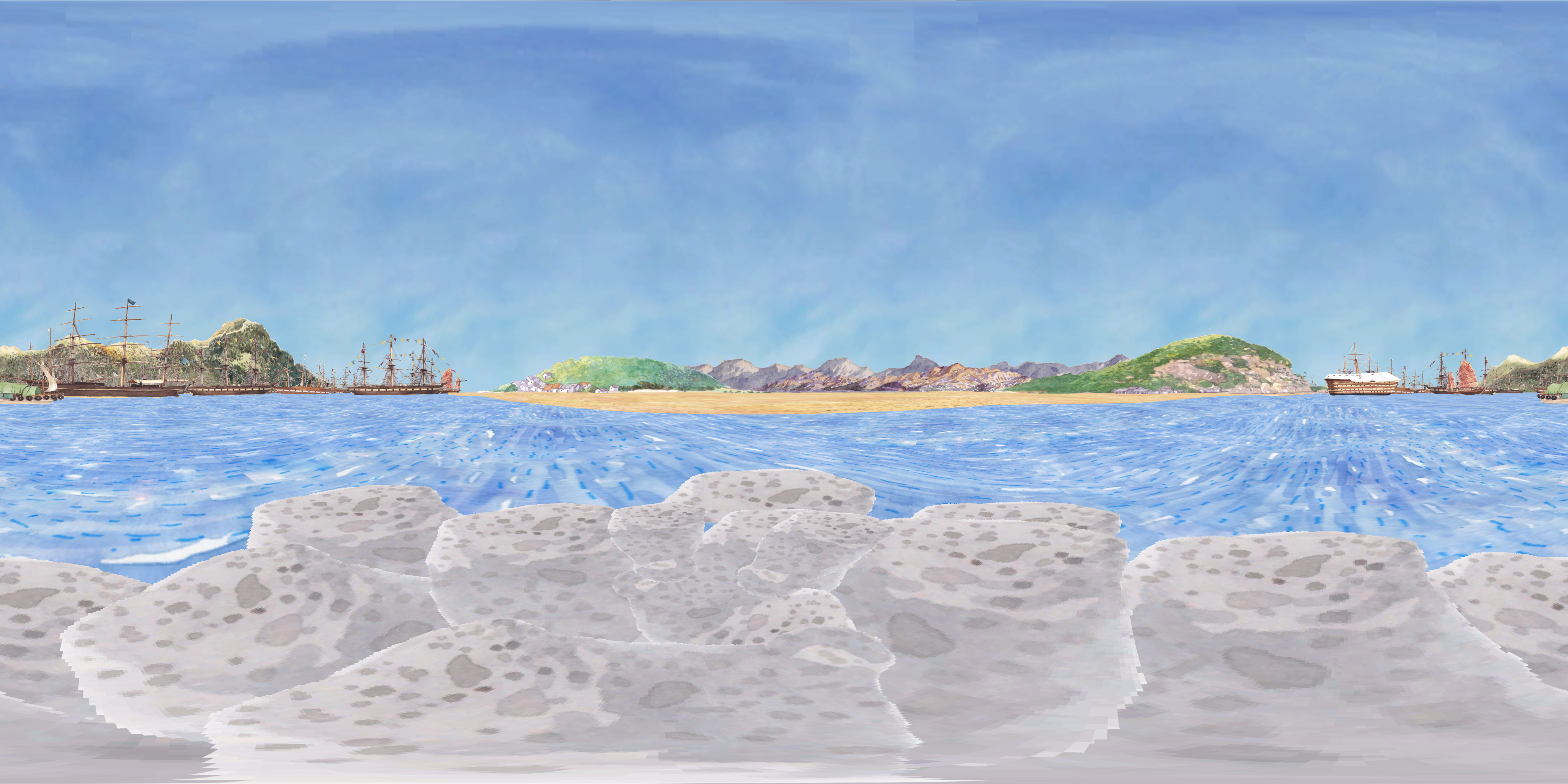
360-degree panoramic artwork created by Wong Chun Hei
Historical Hotspots:
Blackhead Point
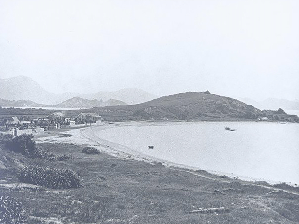
The small hill used to be called “Blackhead Point” in the early years due to a company called Blackhead and Co. residing downhill. In 1907, the time ball tower which used to be located in front of the Marine Police Headquarters was moved to that location, and it continued to provide time service for mariners and the public since 1908. The time ball was a hollow copper ball with a diameter of six feet. It was raised by hand-winch to the top of the mast before 1 p.m. and it automatically dropped to the bottom of the mast at 1 p.m. From 1920 to 1933, the time ball scheduling was changed to twice a day at 10 a.m. and 4 p.m. The Signal Tower used flags or lights to send signals to the mariners, so people started calling the location Signal Hill.
Another name for Blackhead Point was “Tai Pau Mai (Big Rice Bag)”– this was because the hill was too small to be called a mountain. Instead, it looked like a bag of rice lying on the ground. The place was once a strategic high point for the British army with the Kowloon East Fort originally built here, and it guarded the Victoria Harbour together with the Kowloon West Fort near the former Marine Police Headquarters. The Signal Tower was requisitioned as a temporary ammunition dump during World War II, then it was abandoned for years. In 1958, the British army returned Blackhead Point to the government.
Photo courtesy of the Hong Kong Museum of History
Hong Kong Island
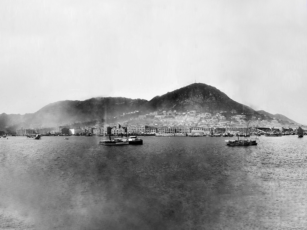
What was Hong Kong like when it first opened its port to foreign trade? At that time, Hong Kong Island was a small fishing village with only 16 villages. With the increase in population following urban development, Sheung Wan, Central, and Ha Wan became the first few areas developed on Hong Kong Island, namely the “City of Victoria”. Starting in the 1840s, there were wars in Mainland China causing many refugees to flee to Hong Kong to make a living. Rapid population growth urged the Government to develop more land for use, so there were reclamation projects in Sai Ying Pun, Wan Chai and Sheung Wan. After building up these areas, the government erected six boundary stones in 1903 to indicate the boundary of the “City of Victoria” . The boundary stones still exist today. The Chinese named the area “four rings and nine districts”.
There are different stories on the origin of the name “Hong Kong”, one of which is related to fragrance. Before Hong Kong became a colony, there were many agarwood and incense factories that spread scent and aroma. Another said that Shek Pai Wan (Aberdeen) was a place where fragrant wood was sold and transported, and this was where the name “Hong Kong” came from. In fact, “Hong Kong” was recorded on the map of “Yue Da Ji” (grand record of Guangdong) in the Ming Dynasty as early as the 16th century, but at that time it referred to a bay on the island, instead of Hong Kong Island.
Photo courtesy of Moonchu Foundation and the Hong Kong Museum of History
Temporary Military Tents
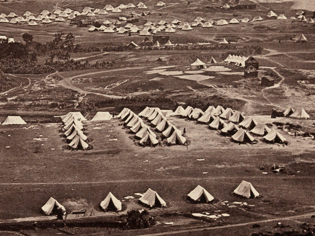
In 1860, the British occupied the Kowloon Peninsula after signing the “Convention of Peking” with the Qing government and set up barracks for the garrison near the current Kowloon Park and Gun Club Hill. At that time, there were no permanent barracks in the British camps, but only simple tents. The British army established permanent buildings in Kowloon Park and Gun Club Hill in 1892 and 1902 and named them as Whitfield Barracks and Gun Club Hill Barracks respectively. In 1910, they subsequently built more than 80 2-storey barracks. The barracks were used as concentration camps by the Japanese army during the Japanese occupation. In 1967, the government reclaimed the land. Three years later, the area was converted to Kowloon Park. Only 4 barracks were preserved.
Different opinions were held between the British army and the Hong Kong Government on the function of the Kowloon Peninsula. The British army perceived that Kowloon was directly under the British Government, so the military should have the full right to use and manage. Still, Governor Robinson recognised that the “Convention of Peking” listed Kowloon as a colony. If it were handed over to the military, it would not be beneficial to the development of the entire colony. Facilitated by the British Government, the two parties finally reached a consensus in 1864. The colonial government allocated part of the land for the army to construct barracks, and the rest was to be managed by the government.
Kowloon, Hong Kong: military encampments (pic 4 of 6)
Photo courtesy of Wellcome Collection. CC BY
Lion Rock
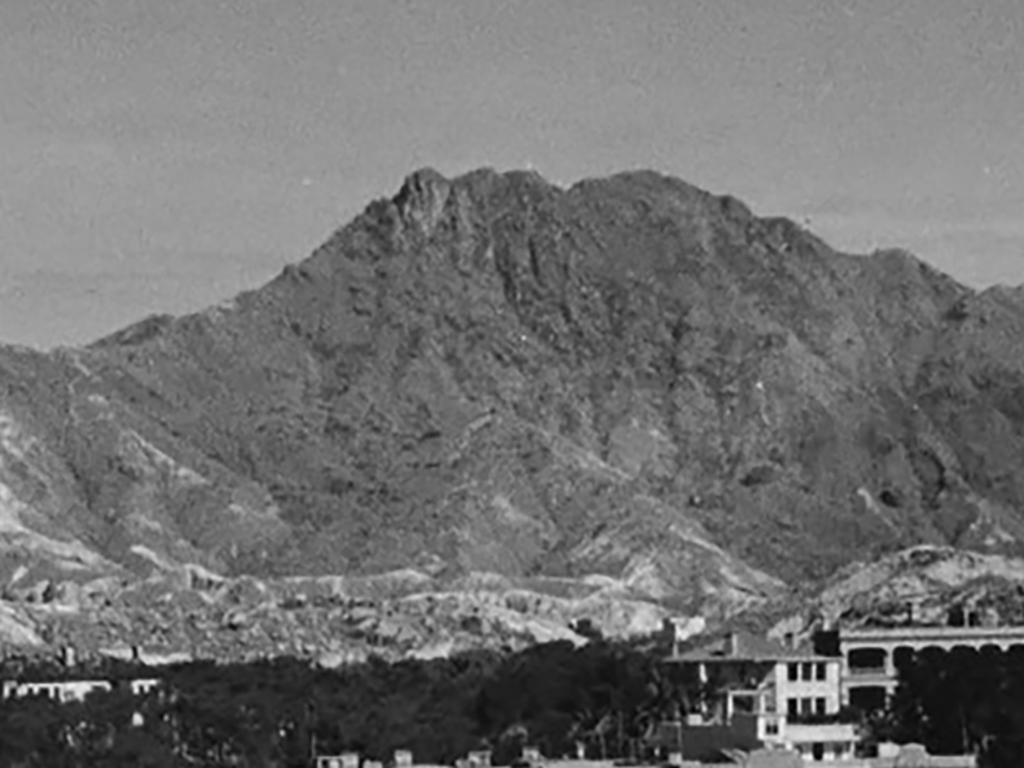
The song “Below the Lion Rock” in the 1970s engraved the Lion Rock as a spiritual symbol of the Hong Kong people. It is one of the peaks between the Kowloon Peninsula and the New Territories. Lion Rock is 495 metres high and connected to the nearby 458 metres high Beacon Hill. The rock on the west side of the mountain has a shape like a crouching lion majestically overlooking Hong Kong. There are stone paths on both sides of the Lion Rock and each leads the way to Shatin. In the Qing Dynasty, these two paths were the main routes between Kowloon and Sha Tin.
“There are joys in life and tears in time. Eventually, we shall all meet under the Lion Rock.” The song “Below the Lion Rock” describes the relationship between Hong Kong people and the Lion Rock. The mountain is a famous landmark in Hong Kong, as it witnessed the development and changes of the city over time. The TV series “Below the Lion Rock” in the 1970s portrayed the stories of people in Hong Kong at that time as they struggled to earn a living. Many of us take the Lion Rock to symbolise the spirit of the Hong Kong people as they fight to overcome the challenges of life.
Photo courtesy of photographs and negatives in the Hedda Morrison photograph collection: Copyright various dates, President and Fellows of Harvard College; all rights reserved.
Animation:

Back to the days of the 1860s, most ships berthed on the sea area to the west of Victoria Harbour and the Kowloon Peninsula, notably the widest location of the harbour. The goods and cargo were all transported to the shore via a fleet of barges.