The Peak – Lion’s Point View Pavilion ca.1966
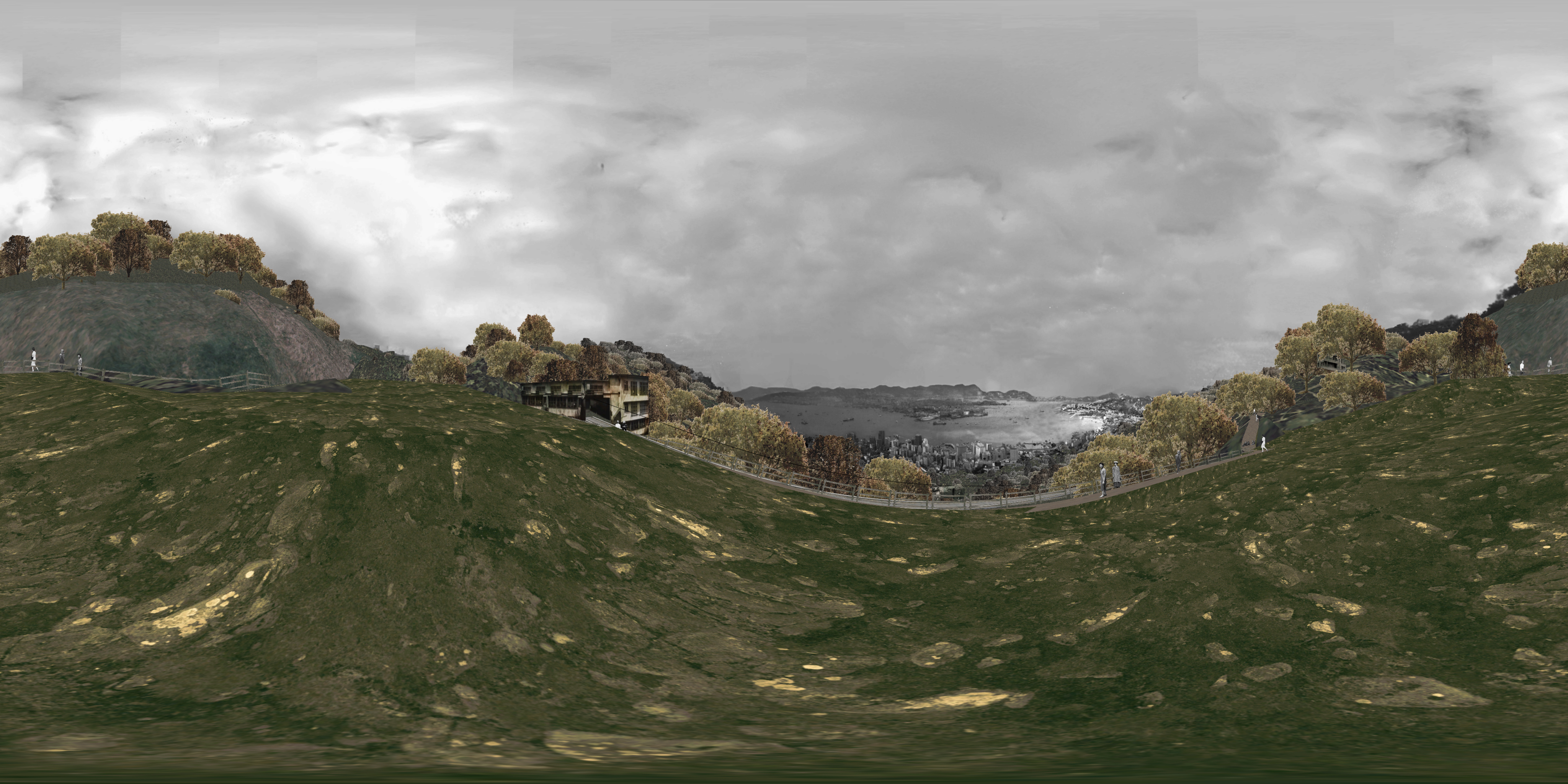
360-degree panoramic artwork developed from historical photos
Historical Hotspots:
Land Reclamation in Victoria Harbour
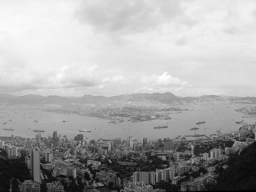
Since the inception of Hong Kong as a port, the shoreline along Victoria Harbour has been shaped and reshaped over time due to reclamation projects. The first official plan for land reclamation, namely the Bonham Strand reclamation project, was hatched in Sheung Wan in the 1850s. The construction route began from the intersection between Wellington Street, Jervois Street, and Queen’s Road Central to the junction of Jervois Street and Morrison Street. Once Bonham Strand had been formed, its waterfront was extended westward by reclamation from Bonham Strand East to Kennedy Town, eventually becoming the paved present-day Des Voeux Road West. Following World War II, the government undertook multiple coastal reclamation projects continuously to boost land supply for the city’s growing population and economy. After the Protection of the Harbour Ordinance was enacted in 1997, reclamation works in Hong Kong were moderately limited.
The reclaimed lands surrounding the Victoria Harbour served a multitude of purposes. In the 1950s, the site of Causeway Bay Typhoon Shelter was reclaimed to provide land for the Victoria Park. Stepping forward to the time between the mid-1960s and the 1970s, the government initiated a reclamation project in Wan Chai to expand the land from Gloucester Road to its north in stages. This project aimed at providing land for commercial and governmental buildings, covering Wan Chai as part of the business district from Central. As for the Kowloon district, Kai Tak Airport expanded its infrastructure and constructed new runways with the newly filled land at the end of the 1950s. Starting from the 1960s, the reclaimed land from Tsim Sha Tsui East to Hung Hom was designated to make room for the new terminal of Kowloon-Canton Railway, commercial premises, hotels, and residential housing respectively. Throughout the history, it is evident that land reclamation has been essential to the urban development of Hong Kong.
Photo courtesy of Government Photo Store, Information Services Department
The Peak Tram
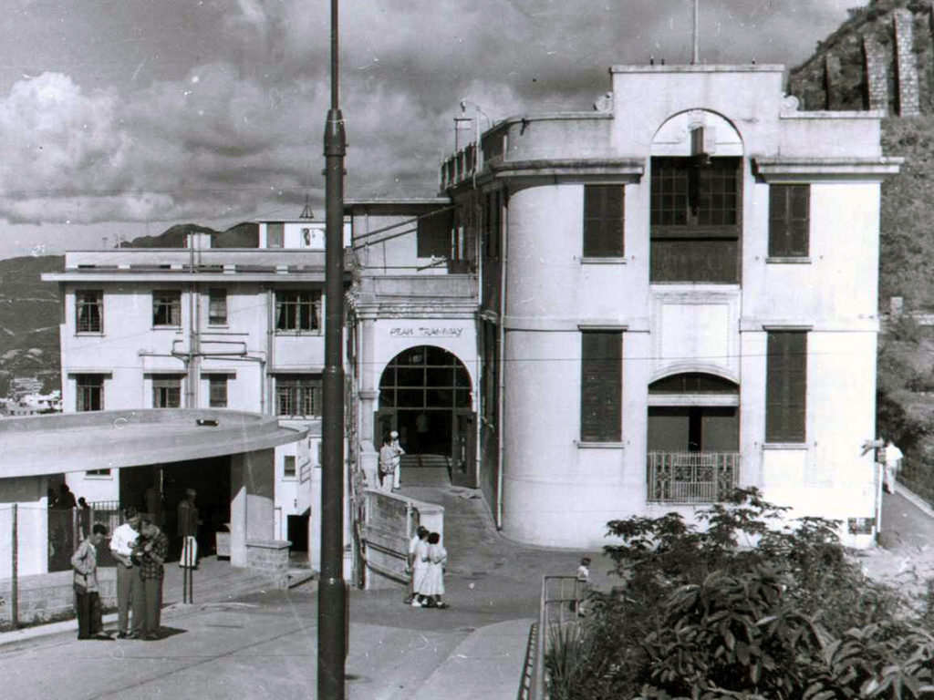
A Scotsman Mr. Alexander Findlay Smith introduced his blueprint for boosting the development of the Peak in May 1881. His proposed strategy was to devise a new tram system to connect Victoria Gap with Murray Barracks. In the following year, the Hong Kong High Level Tramways Company was founded upon the approval of the government on the project. The Peak Tram was the sole means of transportation that directly carried passengers up and down between Central and the Peak, until the opening of the Old Peak Road in the 1920s.
As the first cable funicular in Asia, the Peak Tram officially commenced its public service on 30 May 1888. The railway track was constructed along the hillside, stretching 1,350 metres, and rising from 28 metres to 396 metres above sea level. Between 1908 and 1949, the two seats in the first row could not be occupied until the last two minutes before the tram’s departure because they were reserved for the Governors of Hong Kong and their ladies. A bronze plaque inscribed with “This seat is reserved for His Excellency, the Governor” was affixed to the back of the seats. Compared with the first-generation tramcar which seated 30 passengers, the fifth-generation Peak Tram accommodates up to 120 passengers per trip. Seat reservation is no longer required.
Photo courtesy of Peak Tramways Company, Limited
Animation:

The all-aluminium, fourth-generation tramcar carrying up to 72 passengers was put into service in 1959 and came to an end in 1989. With the newly upgraded design of tram carriages, passengers were well protected from any weather conditions and could enjoy the spectacular and picturesque views of Hong Kong all along their way cosily. Back in the 1950s, Hong Kong had been promoting riding the tram to the Peak as a tourist attraction. To this day, visiting the Peak by tram is still a popular travel activity among tourists.